6 Best Handheld Marine GPS with Maps for Boaters (2026)
Compare 6 handheld marine GPS with maps for boating. See which unit suits coastal charts, hiking-style topo maps, satellite messaging and rugged use on the wate
 By Graham Fisher
Updated November 20, 2026
 By Graham Fisher
Updated November 2026
A handheld marine GPS with maps gives you a backup position fix, a chart you can read in the cockpit, and a navigation tool that keeps working when your chartplotter fails or you leave the boat. This list focuses on chart coverage, screen readability, waterproofing, battery life and satellite support, and it covers units for coastal sailors, small-boat users and multi-purpose outdoor use.
Our top picks at a glance
- 1TOP CHOICEBest overallGarmin GPSMAP 79scView on Amazon
- 2
 TOP CHOICEBest for satellite messagingGarmin GPSMAP 86SciView on Amazon
- 3
 TOP CHOICEBest for button operationGarmin GPSMAP 65View on Amazon
- 4
 Best for topo mappingGarmin GPSMAP 64sxView on Amazon
- 5
 Best for compact rugged useGarmin eTrex 22xView on Amazon
- 6
 Best budget pick for hiking-style mapsHandheld GPS for Hiking with USA Topo MapView on Amazon
Our Top Picks
Quick Comparison
| Product | Best for | Key feature |
|---|---|---|
| Garmin GPSMAP 79sc | Coastal boating | Preloaded BlueChart g3 charts |
| Garmin GPSMAP 86Sci | Satellite messaging | inReach communication built in |
| Garmin GPSMAP 65 | Button operation | Multi-band satellite support |
| Garmin GPSMAP 64sx | Topo mapping | TopoActive maps and altimeter |
| Garmin eTrex 22x | Compact rugged use | AA battery operation |
| Handheld GPS for Hiking | Budget topo navigation | USA Topo Map and large screen |
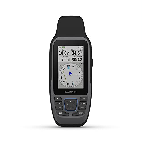
Garmin GPSMAP 79sc
Garmin GPSMAP 79sc, Marine GPS Handheld Preloaded with BlueChart g3 Coastal Charts, Rugged Design and Floats in Water
Best for: coastal boating with marine charts
Suited to sailors and powerboaters who want chart detail on a handheld that floats and is built for wet conditions. Manufacturers specify preloaded BlueChart g3 coastal charts.
Pros
- Preloaded marine charts out of the box
- Floats in water, useful if it goes overboard
Cons
- Small screen for detailed chart work
Garmin GPSMAP 86Sci
Garmin GPSMAP 86Sci, Floating Handheld GPS with Button Operation, Preloaded BlueChart G3 Coastal Charts And Inreach Satellite Communication capabilities, Stream Boat Data From Compatible Chartplotters
Best for: satellite messaging alongside navigation
Aimed at offshore and cruising sailors who want two-way satellite messaging and a backup navigation unit in one device. Owners often report that the boat-data streaming to compatible chartplotters adds practical value.
Pros
- inReach satellite communication built in
- Preloaded BlueChart g3 coastal charts
Cons
- Messaging features add complexity and require a subscription
Garmin GPSMAP 65
Garmin GPSMAP 65, Button-Operated Handheld with Expanded Satellite Support and Multi-Band Technology, 2.6" Color Display, 010-02451-00
Best for: button-operated use with wet hands
A good match for dinghy and small-boat sailors who prefer physical buttons over a touchscreen. Manufacturers specify expanded satellite support and multi-band technology for better signal in marginal conditions.
Pros
- Button operation works with gloves
- Multi-band satellite reception
Cons
- 2.6-inch display is small for chart detail
Garmin GPSMAP 64sx
Garmin 010-02258-10 GPSMAP 64sx, Handheld GPS with Altimeter and Compass, Preloaded with TopoActive Maps, Black/Tan
Best for: topographic mapping and terrain reference
Fits sailors who also explore shorelines, rivers and trails and want terrain context. Manufacturers specify preloaded TopoActive maps, an altimeter and a compass.
Pros
- Altimeter and compass built in
- TopoActive maps suit land-based use
Cons
- Topo maps are less detailed for marine navigation
Garmin eTrex 22x
Garmin 010-02256-00 eTrex 22x, Rugged Handheld GPS Navigator, Black/Navy
Best for: compact, rugged backup navigation
Suited to small-boat users who want a lightweight backup that runs on common batteries. Owners often report that it is simple to operate.
Pros
- Simple, compact design
- Runs on AA batteries
Cons
- Limited marine chart detail compared with dedicated marine units
Handheld GPS for Hiking with USA Topo Map
Handheld GPS for Hiking, Rugged and Waterproof Handheld GPS Navigator, 3.2" Sunlight Readable Screen, Compact Satellite Handheld GPS with USA Topo Map, Multi-GNSS Support, Extra Battery Life
Best for: budget topo navigation on shore and water
A practical option for shoreline explorers and paddlers who want a large sunlight-readable screen on a lower-cost unit. Listing details include multi-GNSS support and extra battery life.
Pros
- 3.2-inch sunlight-readable screen
- Multi-GNSS satellite support
Cons
- Not a dedicated marine unit, so chart coverage is limited
Buying Guide
Chart coverage
Marine units use coastal or inland charts with depth soundings, buoys and hazards. Check whether the preloaded maps cover your sailing area before you buy.
Screen size and readability
Larger screens are easier to read in glare, but they draw more power. Look for a display that stays readable in direct sun at arm’s length.
FAQ
Do I need a handheld marine GPS if my boat already has a chartplotter?
A handheld unit is a useful backup if your chartplotter fails, loses power, or is damaged. It also lets you navigate from a dinghy, kayak, or another part of the boat where the main display is not visible.
What is the difference between preloaded coastal charts and topo maps?
Coastal charts such as BlueChart g3 show depths, buoys, hazards, and marine features, which is what boaters need on the water. Topo maps focus on land contours, trails, and terrain, so they suit hiking more than boating.
Are these units truly waterproof enough for boat use?
Most of the models in this list are rated for water resistance and rugged use, which handles rain, spray, and accidental immersion. Check each product’s specific rating and keep the unit in a protective case or mount when you are not using it.
Do I need to buy extra chart cards or subscriptions?
Some units come with charts already loaded, while others may need additional map data for your cruising area. Confirm the chart coverage for your region before buying so you are not left without detail where you boat.
Can a handheld GPS send messages or share boat data?
Models with satellite communication can send and receive messages when you are outside cell range, which adds a safety layer offshore. Some units can also stream data to compatible chartplotters, so you can share position and depth information across your electronics.
How long does the battery last on a handheld marine GPS?
Battery life depends on screen brightness, backlight use, and whether you use satellite features, so runtime varies widely. Carry spare batteries or a power source for longer trips, and check the manufacturer’s stated battery specifications for each model.
Conclusion
For coastal sailors and powerboaters who want a serious backup chartplotter, the Garmin GPSMAP 79sc and GPSMAP 86Sci are the strongest options, with the 86Sci adding satellite messaging and boat data streaming. Small-boat and kayak users who need a readable marine chart on a compact unit should look at the GPSMAP 65 or the preloaded BlueChart g3 option.
If your use is mostly land-based with occasional water trips, the GPSMAP 64sx with TopoActive maps or the eTrex 22x offers a practical balance of rugged build and navigation features. Choose the model whose chart coverage, screen size, and satellite support match where and how you actually boat.
Related reading
- Top 6 Handheld Marine Radios with GPS Models for Boaters
- Top 5 Handheld Marine VHFs with GPS Worth Considering in 2026
- Handheld Marine GPS Units: How to Choose the Right One (2026)
About Graham Fisher
Graham Fisher is part of our editorial team and reviews and edits our sailing gear guides, checking product details against manufacturer specifications and owner feedback.
About the author
Graham Fisher writes reviews and buying guides for Sailing The Web.